
Bhal region, Gujarat · 22°12′47″N 72°13′06″E
The villages of the Dholera SIR
Dholera SIR is a greenfield industrial city planned on the Delhi–Mumbai Industrial Corridor, spanning roughly 920 sq. km in Dholera taluka. Its boundary is drawn around a core set of revenue villages, whose land falls across the region's Town Planning schemes.
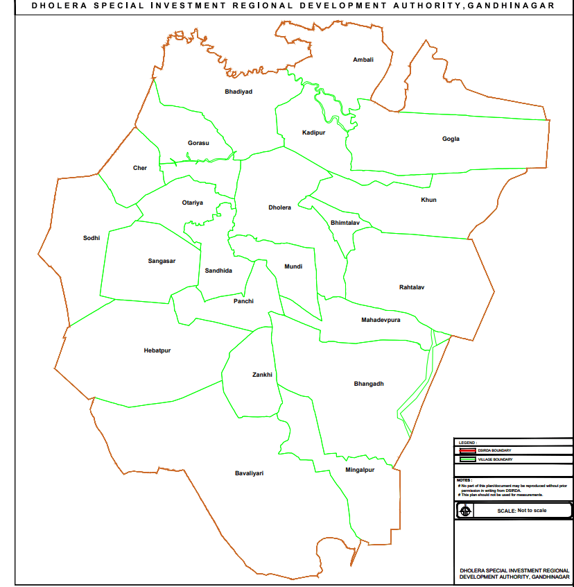
Villages within the boundary
Names and spellings vary slightly across government notifications and press coverage — treat as a reference, not a legal record.
- Dholera
- Bavaliyari
- Sareshalpara
- Bhangadh
- Panchi
- Sandhida
- Rahtalav
- Mingalpur
- Bhimtalav
- Gandhipur
- Mahadevpura
- Zankhi
- Rajpur
- Kandipur / Kadipur
- Gogla
- Navagam
- Khun
- Bhadiyad
- Gorasu
- Otariya
- Ambli
- Pipli
Survey notes
- Total area
- ≈ 920 sq. km
- State / district
- Gujarat / Ahmedabad
- Taluka
- Dholera
- From Ahmedabad
- ≈ 100 km, southwest
- Governing authority
- DSIRDA
- Revenue villages
- ≈ 22
For an authoritative, legally binding list of villages and Town Planning scheme boundaries, consult the Dholera SIR Development Authority (DSIRDA) directly rather than this page.