Regional trade networks
Gujarat's coastal geography supported extensive regional and maritime commercial activity, connecting inland production with coastal markets.

History of Dholera
Dholera's story stretches from its historical relationship with Gujarat's trading landscape to its modern role as a planned industrial and urban development region.
The Story of Dholera
Dholera's historical identity is closely connected with its location in the coastal landscape of Gujarat and its proximity to the Gulf of Khambhat.
Over time, the economic role of the region changed as trade routes, transportation networks and major ports evolved.
In the modern era, Dholera entered a very different phase of development, with large-scale planning focused on industrial infrastructure, connectivity and urban development.
Ancient Significance
Dholera's location near the Gulf of Khambhat has long been an important geographic characteristic of the region. The broader area has archaeological and historical associations with Gujarat's ancient settlement and trading networks.
Its position within the coastal landscape helped connect the region with wider patterns of movement, agriculture and trade.
Medieval & Colonial Periods
Gujarat has historically been one of the important commercial regions of western India. Dholera and nearby areas were part of a wider network shaped by agricultural production, coastal trade and changing political and economic systems.
As transportation systems and major ports developed, the importance of individual coastal trading locations changed. This contributed to the transition of Dholera away from its earlier role as a local trading location.
Gujarat's coastal geography supported extensive regional and maritime commercial activity, connecting inland production with coastal markets.
The development of newer ports, roads and transportation systems gradually changed how goods and people moved through the region.
The Modern Transformation
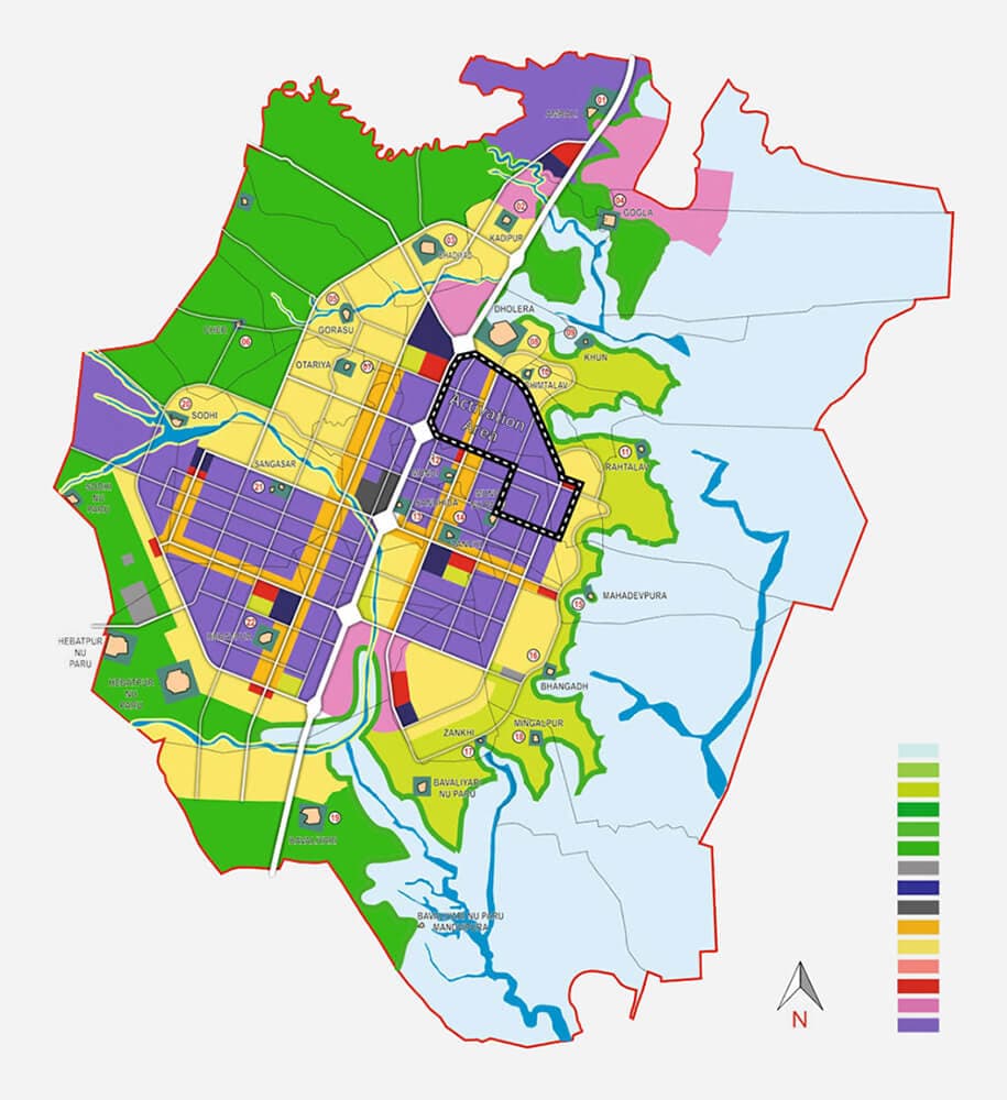
The modern development vision for Dholera represents a major change in the region's role. Instead of growing primarily through organic settlement, the new development model is based on planned infrastructure and designated land uses.
Dholera SIR forms part of Gujarat's Special Investment Region framework and the wider Delhi-Mumbai Industrial Corridor development landscape.
The focus is on creating an environment capable of supporting manufacturing, technology, logistics and other industrial activities alongside supporting urban infrastructure.
Four Historical Layers
The region's history extends back many centuries, with its geography influencing settlement and economic activity.
Its proximity to the Gulf of Khambhat connected the wider region with Gujarat's historical maritime networks.
Trade routes and transportation patterns evolved over time, changing the economic role of the region.
Modern Dholera represents a transition from a historically rural and trading landscape toward planned industrial development.
Timeline
The region's story can be viewed as a progression from historical settlement and trade toward planned industrial development.
The wider Dholera region has a long history connected with settlement, agriculture and trade. Its location near the Gulf of Khambhat placed the area within Gujarat's broader maritime and commercial landscape.
Dholera and the surrounding region remained connected with Gujarat's evolving trade networks. The area's relationship with the Gulf of Khambhat contributed to its historical commercial significance.
Changes in regional transportation and maritime trade gradually altered the importance of smaller traditional trading locations as newer ports and commercial routes expanded.
Dholera was identified for large-scale planned industrial and urban development as part of Gujarat's Special Investment Region framework and the wider Delhi-Mumbai Industrial Corridor.
Dholera SIR is being developed as a large-scale industrial and urban region supported by planned infrastructure, connectivity and a growing focus on advanced manufacturing.
Then
Historical Dholera developed within Gujarat's coastal landscape, with agriculture, settlement and regional commerce influencing its identity.
Now
Modern Dholera is being developed around planned infrastructure, industrial activity, connectivity and long-term urban growth.
Continue Exploring
Understand the scale, planning framework and modern development of Dholera SIR.
Explore →Learn how infrastructure and industrial development are being planned and implemented.
Explore →See visual references covering Dholera's infrastructure and transformation.
View Gallery →From History To Future
The history of Dholera provides context for its location. Its modern development framework explains where the region is heading next.